Really Navionics - really?
We use an app called Navionics for navigation, route planning, etc. Navionics is owned by Garmin.
The charts aren't perfect, but there is a wealth of information available in them. We really appreciate the level of detail it provides.
Usually, anyway...
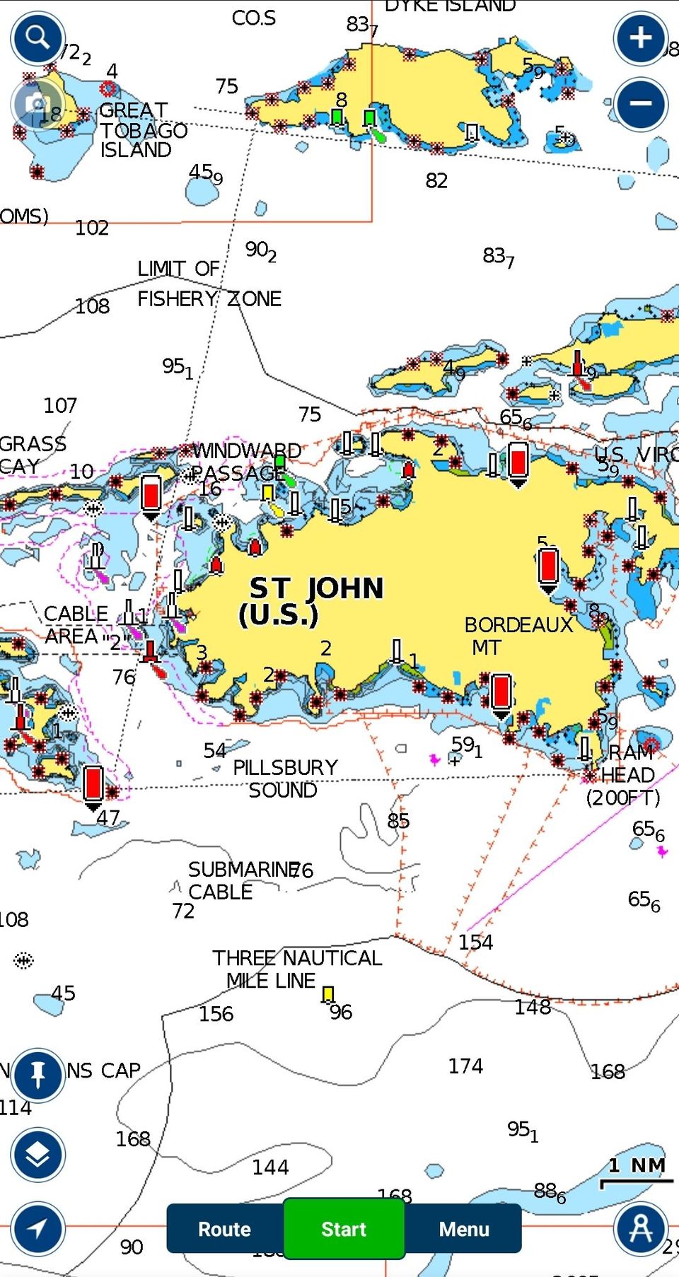
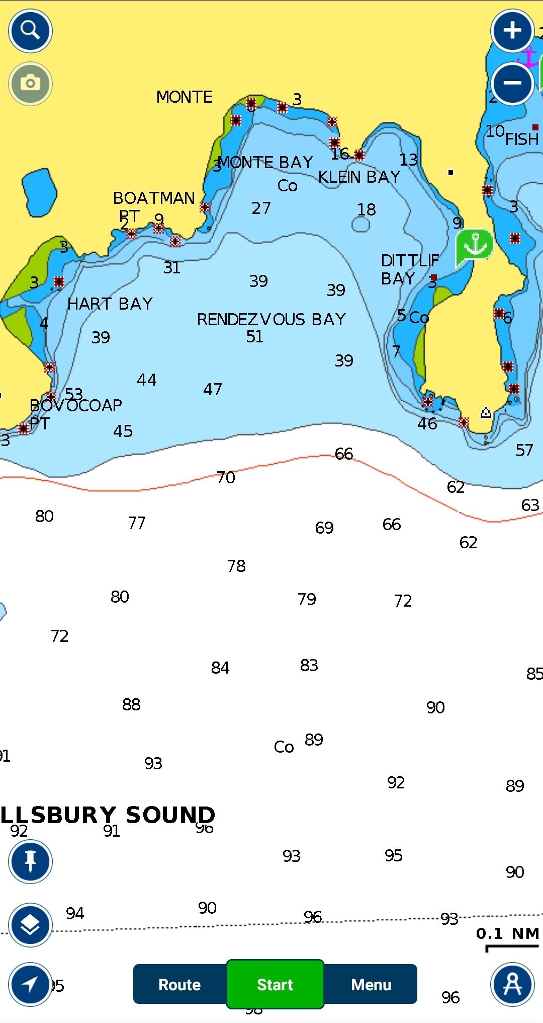
I was looking at an area that we are likely to sail to on Thursday, and wanted to see information about a red line that was drawn on the map, just outside of the shallow blue area.
Red lines usually have a significant meaning, something that you should pay attention to. This is probably important. When I zoomed in, this is what it showed me:
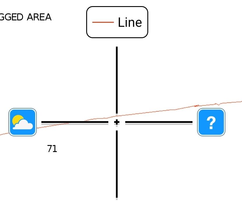
As our good friend Kym noted, obviously "line is line".
Thank you, Navionics, for your keen insight and knowledge...what would we do without you?